
What is the Round Berkshire Cycle Route (RBCR)
The Round Berkshire Cycle Route is a road based cycling route that broadly traces the perimeter of the county for around 140 miles. The route was devised by Berkshire County Council in the mid 1990’s. However following the dissolution of the council in 1998 the route has fallen in a bit of disrepair. In many places signs have either worn away or are missing. Indeed there is a large chunk in the east where signs are missing for many miles.
Having ridden the route back in the 90’s when it was first launched it would be a shame to see it forgotten entirely. We have decided to re-map it and provide a guide / cue sheets so that people can ride and enjoy the route whenever they want.
At 140 miles only the most adventurous will attempt the ride in one day. With this in mind we have split the route into three rides of 42 miles, 48 miles and 50 miles. Each ride starts and finishes near to a railway station making travel easy for those wishing to split the route in to separate day rides.
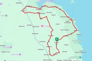
The route starts at Caversham Bridge in Reading and moves in a generally anti-clockwise direction. It heads west to Lambourn before turning south to Hungerford. From Hungerford it’s east bound through Newbury and Bracknell to Windsor. From Windsor it’s back westward again to Reading. This mimics the route / directions from the original information sheet published in the 90’s.
Note – This is the original route as far as we can ascertain. However, due to the lack of signage and the fact we are working from some very old notes coupled with odd bits of information gleaned from the internet this route may deviate slightly from the original in places. If you know of a deviation or see sign that is not on our route then please contact us so that we can update. Additionally we found that some signs seem to have been turned and were pointing in the wrong direction. If you follow our instructions carefully and ignore any of those signs you will be fine.
Start Point – Caversham Bridge, Reading
Distance – 139 miles / 209 km
Elevation Gain – 6196 ft / 1888 m
We have broken the route down in to three different rides:
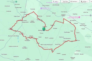
- Reading to Hungerford at 42 miles – click here to visit the route description.
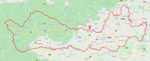
- Hungerford to Martins Heron at 48 miles – click here to visit the route description.
- Martins Heron to Reading at 49 miles – click here to visit the route description.
Each page has an overview description and the ability to download a media pack containing a map, GPX file and turn by turn text directions as well as links to the original ‘Ride with GPS’ map pages.
Ride with GPS Link for the entire route – https://ridewithgps.com/routes/35123402
Media pack download for the entire route – Click Here
If you’re also taking part in the Berkshire Bicycle Quest you will find that the Round Berkshire Cycle Route will also take you past or very close to a number of the checkpoints, so why not do both at the same time.
As with our other routes we have provided details of refreshment stops, places of interest and also bicycle shops. We make no recommendations of these places but they may come in useful if you are stuck.
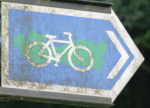
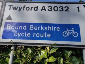
Signage
Whilst many of the original signs have been lost there are still a number of signs along the route. In addition to the sign above there are a number of other designs, a couple of which are shown below. The majority of the signs you come across will have the black or white bike / green county graphic. The signs may point left, right, or straight ahead or be part of a larger direction sign as shown below.
|
|
|
If you liked this page please consider supporting us by buying me a tea at www.buymeacoffee.com/cyclinglabs