
Marlborough and the Savernake Forest
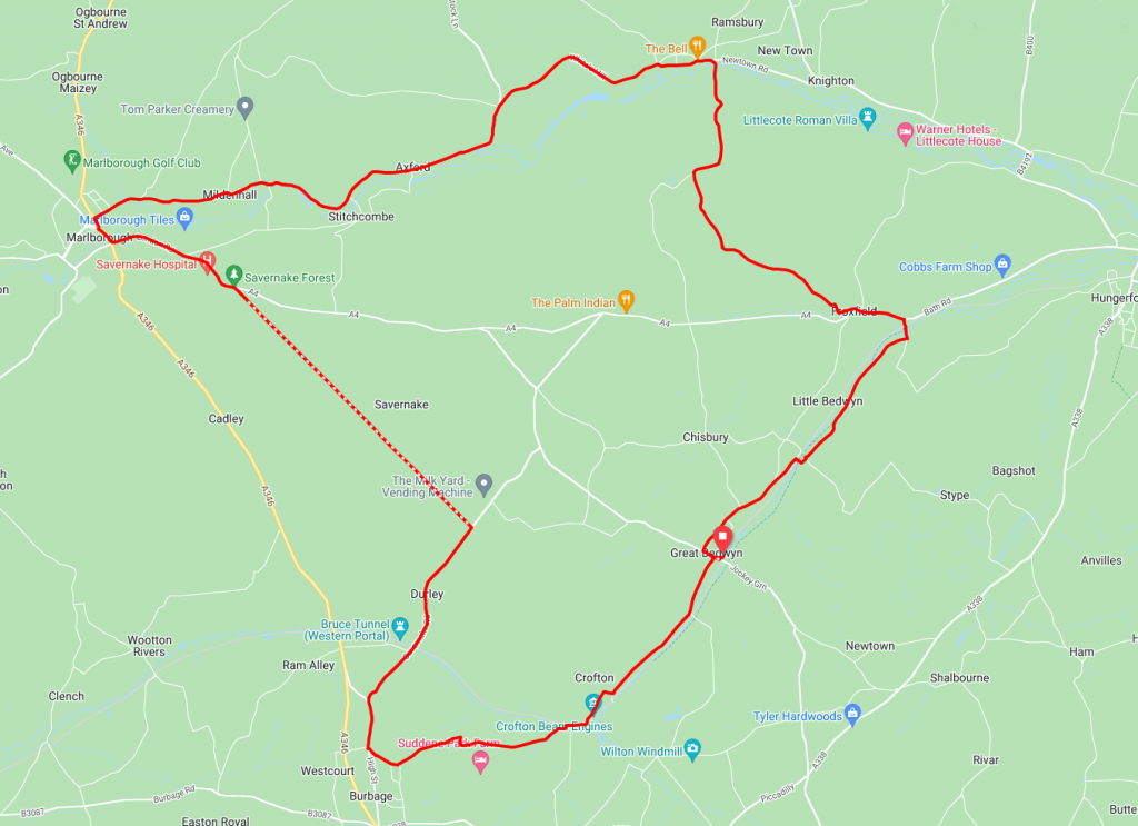
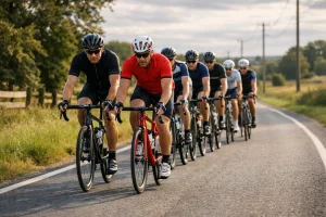
This rolling route between the small Wiltshire towns of Great Bedwyn and Marlborough may only be around 24 miles in length but packs in plenty of interesting sights. Canals, ancient forests and steam waterways are all among some of the sights to be seen. There are a few climbs but the stunning scenery more than makes up for that.
Route Description
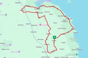
The route starts at Bedwyn railway station in the small town of Great Bedwyn. Trains run frequently and there is a car park if you wish to drive to the start.
From the station, the route runs briefly along Brook St and the High St before turning on to Browns Lane where for the next 2.5 miles or so the road tracks generally parallel to the River Dun. After about three miles the route crosses the river and joins the A4 for a short stretch.
Once on the A4 it’s a quick run in to Froxfield and then back on to some country lanes. From Froxfield the route takes Church Lane and climbs steadily through Rudge for the next 2.5 miles until it reaches the outskirts of Ramsbury.
After a pleasant downhill run in to Ramsbury and through the High Street it’s on to the second steep climb of the ride at White Hill. Once you’ve caught your breath and admired the views at White Hill it’s generally downhill to Marlborough. The road here generally follows the River Kennet through Axford and Mildenhall before arriving in Marlborough.
If you’re looking for somewhere for refreshment there are plenty of places to stop in Marlborough. After leaving Marlborough it’s the last major climb of the day along the A4 to Savernake Forest. Once at the top of the hill, the entrance to the Forest is along Grand Avenue to the right. The road through the forest can be a little bumpy in places so caution is advised here. Follow this road on a straight line for exactly three miles and then take a right turn on to the Savernake Road.
From the Savernake Road it’s a short climb in to Durley and then a gentle downhill stretch in to the village of Burbage. From Burbage it’s the last leg back to Great Bedwyn. After leaving Burbage via the wonderfully named Wolfhall Road the route weaves around a few farms before crossing the canal at Sam Farmer lock. Following the canal, the route is now a short, flat run back to the start at Great Bedwyn.
Route Summary
Start Point – Great Bedwyn railway station
Distance – 24 miles / 38.5km
Elevation Gain – 1380ft / 420 metres
Places of Interest
- British Cycle Quest checkpoint Wiltshire 5 in Ramsbury high street.
- Savernake Forest between mile 15 and mile 18 of the route.
- King of the Limbs historic oak tree – just off the route at the 17.2 mile point.
- Crofton Beam Engines – on the route at the 22.4 mile point.
Refreshment Stops
- Wendy’s Community Cafe & Juice Bar – at the start / finish
- Pelican Inn – on the route at the 3.2 mile point.
- The Bell Ramsbury – on the route at the 7.0 mile point
- The Horsheshoe Inn -on the route at the 11.9 mile point.
- A number of cafes and pubs in Marlborough
- The White Hart Inn is just off the route in Burbage at the 20 miles point.
- Cafe at Crofton Beam Engines on the route at the 22.4 mile point.
Local Bike Shops
- The Marlborough Bike Company, 1-2 Kingsbury Street, Marlborough, SN8 1HU, 01672 515156
Closest Railway Stations
- Great Bedwyn – at the start / finish
- Hungerford – approx 3.5 miles from Froxfield.
Ride With GPS Link – https://ridewithgps.com/routes/39012913
GPX file direct download – Click Here
If you liked this route please consider supporting us by buying a tea at www.buymeacoffee.com/cyclinglabs
To see more great routes go to our Routes Index page