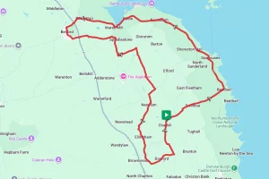

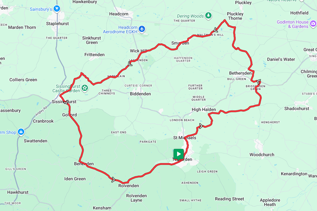
Tenterden and Sissinghurst Loop
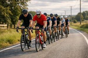
Tenterden in Kent is the starting point for this ride. Unusually, there isn’t a railway station at or near the start point, but there is one on the route, so it should be easy to start there and complete the ride in full. Kent – frequently referred to as ‘The Garden of England provides some stunning scenery but isn’t the flattest, so be prepared for a few hills.
Route Description
From the start point in Tenterden, head along the High Street and Ashford Road in a roughly northern direction. Shortly after leaving Tenterden, the route turns right onto Swain Road and drops downhill for a while. From here, it’s a relatively flat run as the route runs along Swain Road, Harbourne Lane, and Plurenden Road. Eventually, it comes to a crossroads where it meets the Bethersden Road.
At the crossroads, the route turns north for a mile or so before meeting the main A28. From here, there is an unfortunate but unavoidable short stretch along the A28, but it quickly turns onto Mill Lane as it skirts around the edge of Bethersden. From here it’s a relatively straight and flat run north to Pluckley. Before reaching Pluckley itself and just after passing the station, the route turns west briefly along Chambers Green Road and then South to join Smarden Road.
Once on the Smarden Road its a straight and flat run through Maltmans Hill and Biddenden Green before arriving at Smarden itself. If you’re thinking about having a break, we’d recommend stopping here, as the hardest part is soon to come.
Heading south from Smarden, take the opportunity to warm up the legs as you head through Lashenden and on to Hareplain because once you pass Hareplain, the hills begin. Climbing the wonderfully named Digdog Lane and Cranbrook Road the route subsequently skirts around Sissinghurst Estate and into Sissinghurst itself.
After the climb in to Sissinghurst there’s a nice leg resting downhill through Golford before rising again to the highest point of the ride just before Benenden. From Benenden its now five miles of almost continuous free-wheeling downhill. The only thing to stop for is a photo opportunity at the Rolvenden Windmill. Note, though, it’s not open to the public, so please only take photos from the road.
Continuing downhill, the end is in sight; however, after passing Rolvenden station on the heritage railway the last testing climb up in to Tenterden is still to be tackled. With a gradient of around 6% at its steepest it’s a bit of a tester, but once you’re at the top, the ride is finished, and the chance to try out a local cafe has definitely been earned.
Route Summary
Start Point – Tenterden Station Road Car Park TN30 6HN, O.S. Grid Ref – TQ 88208 33359
Distance – 27.5 miles /44.25 km
Elevation Gain – 1120ft / 341 metres
Places of Interest
- Kent and East Sussex Heritage Railway – 0.25 miles from the start point.
- Lashenden Air Warfare Museum – just off the route at the 15.7 mile point.
- National Trust: Sissinghurst Castle Garden – just off the route at the 22.5 mile point.
- Hole Park Gardens – on the route at the 27.0 mile point (Only open part of the year)
- Rolvenden Windmill – on the route at the 27.8 mile point. Note – this is a private building with no public access
Refreshment Stops
- A number of places in Tenterden at the start / finish.
- The Dering Arms – on the route at the 11.1 mile point.
- The Milk House Sissinghurst – on the route at the 22.4 mile point.
- Cafe in Sissinghurst Castle Garden – just off the route at the 22.5 mile point.
- Benenden Community Shop & Cafe – on the route at the 25.6 mile point.
Local Bike Shops
-
RM Cycles – Unit 3A, Leigh Green Industrial Estate, Appledore Rd, Tenterden TN30 7DE . 01580 765612 (www.rmcycles.co.uk)
-
The Bike Workshop – Admirals Walk, Benenden, Cranbrook TN17 4AH. 01580 240202 (on the route at 24.5 miles)
Closest Railway Stations
- Pluckley – on the route at the 11.0 mile point.
Ride With GPS Link – https://ridewithgps.com/routes/39125068
GPX file direct download – Click Here
If you liked this route please consider supporting us by buying a tea at www.buymeacoffee.com/cyclinglabs
To see more great routes go to our Routes Index page