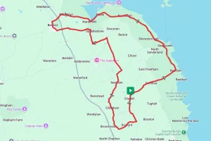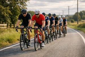

A Lap of Rutland Water
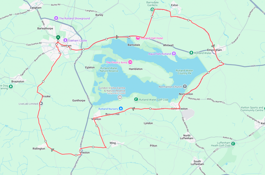
Rutland Water is the largest reservoir in England* and this short, but hilly in places, ride will take the rider broadly around its perimeter. Note – this is not the route of the perimeter of the actual reservoir, but our own route starting and finishing in Oakham that takes in local roads and lanes.
The ride starts and finishes at the Railway station in Oakham, where there is a limited amount of street parking (there is more available in the town centre). Travelling in a clockwise direction, the route skirts along the reservoir’s north shore to Empingham. From Empingham, the route turns westward along the south shore through Edith Weston, Manton and Ridlington before returning to Oakham.
*It is the largest by surface area but not by water volume due to its shallower depth than other reservoirs.
Route Description
Starting from the railway station, the route heads south along Station Road before quickly turning onto the B640 Melton Road and through the town. Keeping on the B640 until it joins the busy A606. The A606 is quite busy so we would thoroughly suggest using the shared foot/cycle path on the south (right) side of the road. After around 3 miles the route leaves the A606 and heads north along Barnsdale Avenue before turning onto Oakham Road and then skirting the village of Exton and into Empingham.
Upon leaving Empingham the route rejoins the A606 again for about half a mile. There isn’t a footpath for the whole stretch, so caution is advised for the last bit. Half a mile after leaving Empingham the route turns right along Normanton Park Road and into the village of Edith Weston.
From Edith Weston the route now runs broadly parallel to the south shore of the lake along Manton Road and into Manton village itself. Once in Manton itself the route then turns south along Wing Road for a mile or so. The first half is downhill, but make the most of it as the second half is steeply uphill.
About halfway up the hill, the route turns right along Preston Road and continues its uphill trend as it passes through the village of Preston and on to Ridlington. From Ridlington there’s a brief respite for the legs as the route turns north and downhill into the valley formed by the River Chater.
Once you’ve passed over the Chater then it’s a straight run back in to Oakham along the Brooke Road. There are however a couple of testing climbs on this short section just to make sure the legs are still working.
Route Summary
Start Point – Oakham Railway Station
Distance – 22.3 miles / 35.8 km
Elevation Gain – 1319ft / 402 metres
Places of Interest
- Oakham Castle – approx 0.25 miles from the start / finish point.
- Rutland Water – You’re never far from it.
- Normanton Church – just off the route at the 10.0 mile point.
- Lyndon Nature Reserve – just off the route at the 12.8 mile point.
Refreshment Stops
Note – Because of where this route is, there is an abundance of places to stop, the ones below are just a small selection.
- Hub and Spoke Cafe – on the route about 0.1 miles from the start / end.
- Waterside Cafe – just off the route at the 10.3 mile point.
- Horse and Jockey Inn, Manton – just off the route at the 14.0 mile point.
Local Bike Shops
-
Sigma Sports – The Old Mill Yard, South St, Oakham, LE15 6HY. 0333 0068833
- Oakham Cycles – 2 Barleythorpe Road, Oakham, LE15 6NR. 01572 757058
- Specialized Rutland Water – Whitwell, LE15 8BL. 01780 460705
Closest Railway Stations
- Oakham – at the start / finish
Ride With GPS Link – https://ridewithgps.com/routes/39111895
GPX file direct download – Click Here
If you liked this route please consider supporting us by buying a tea at www.buymeacoffee.com/cyclinglabs
To see more great routes go to our Routes Index page